
Kerrville ZIP Code Directory Coverage
Kerrville has a practical postal pair. One ZIP is the ordinary street-delivery ZIP for most city parcels and a broad surrounding service area. The other is associated with Kerrville post-office boxes. The distinction matters because a mailed line can be valid without describing a physical place. Use the full address, rather than the city name alone, when checking a delivery ZIP.
| ZIP | Areas covered | Post office | Research note |
|---|---|---|---|
| 78028 | Main Kerrville street-delivery area, plus a broad rural and county service area | Kerrville Post Office serving area | Normal address-search ZIP for city parcels; its boundary is not the city limit |
| 78029 | Kerrville post-office boxes and limited postal use | Kerrville | PO-box ZIP; a box mailing line is not a parcel situs or proof of residence |
For city-level context, the U.S. Census QuickFacts for Kerrville describes the incorporated municipality, which is a different geography from a USPS delivery area.
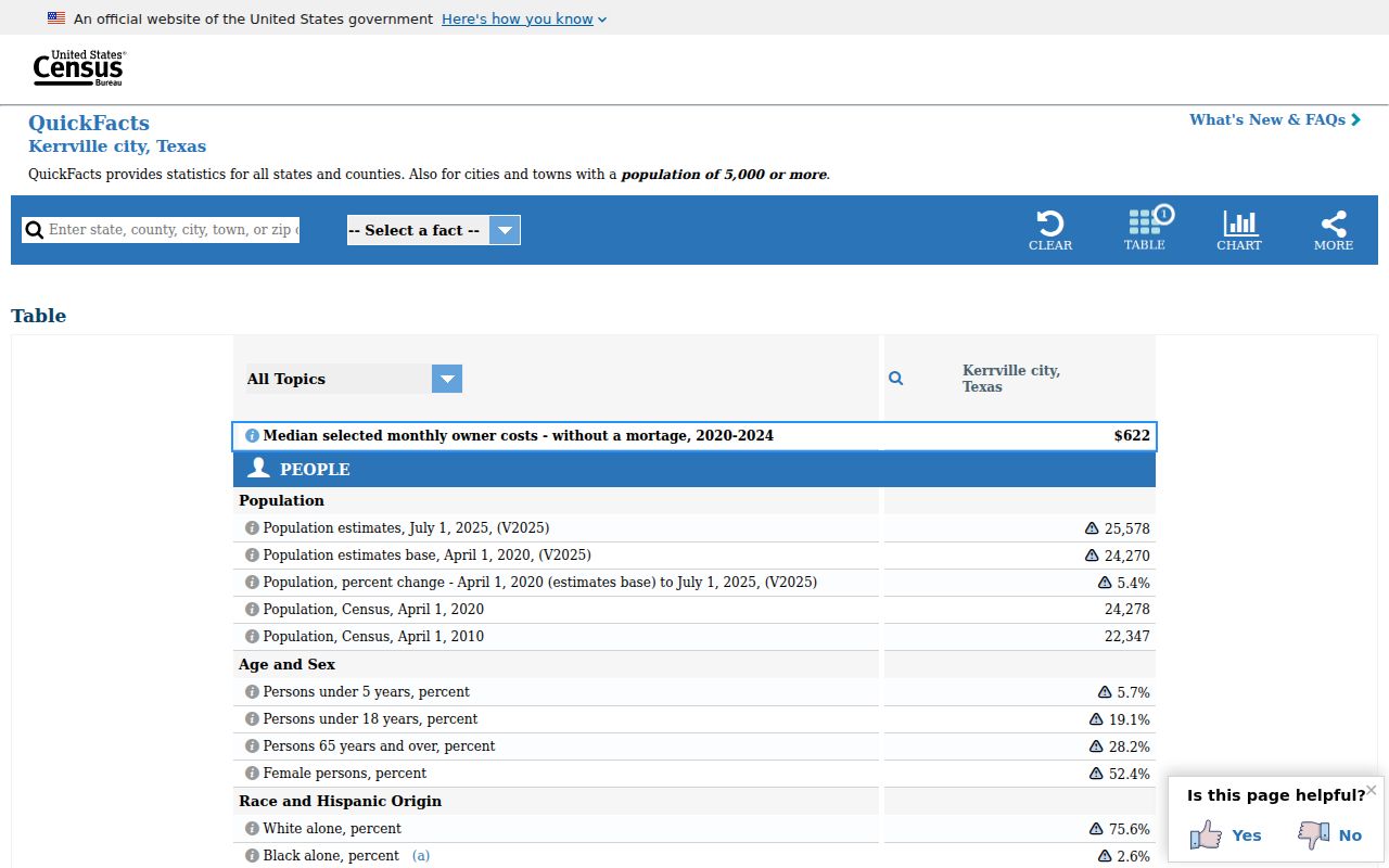
The municipal QuickFacts view provides city context, while a delivery ZIP must still be verified through USPS and compared with a parcel’s jurisdiction.
Kerrville ZIP Code 78028 Geography
ZIP code 78028 is the standard street-delivery ZIP most often associated with Kerrville parcels. It is also large enough to extend beyond the incorporated city and, in ZIP-boundary datasets, is associated with Kerr County and a portion of Gillespie County. That breadth is normal for delivery geography. Mail routes and statistical ZIP areas do not follow every municipal or county line.
The official route for an individual address is the USPS ZIP Code Lookup. Enter the complete street address or a city and state, then retain the returned ZIP or ZIP+4. The result controls the mailing format for that address. It does not replace Kerr CAD, a city-limit layer, or a deed when the question concerns a parcel or jurisdiction.
Kerrville ZIP Code 78029 Mailboxes
ZIP code 78029 is a Kerrville PO-box ZIP. It can appear in a tax or business mailing line, yet it should not be translated into a street address, a parcel location, or a current-residence conclusion. Research records often carry more than one address because each field has a separate administrative purpose.
A CAD result may show a physical situs for the parcel and a different mailing location for notices. A deed can carry a grantee mailing address, while its legal description identifies the land. A 78029 box can therefore be a useful contact clue but cannot do the work of the physical address. Record the field label and source date with the ZIP code.
USPS historical labeling data pairs 78028 and 78029 under KERRVILLE TX 78028, but the shared city label does not erase their different delivery roles. If a Kerrville owner record uses 78029, look for the parcel’s situs and legal description before searching a map. If the question is simply where a letter should go, let the current USPS result control the format.
Search the Kerrville ZIP Code Directory
ZIP-based research starts with the question being asked. USPS confirms postal delivery. The Texas voter portal uses a ZIP only as part of a known-person match. Kerr CAD works from street, owner, parcel, and advanced criteria rather than an exposed ZIP filter. The GIS viewer can add location context only when a relevant layer is visible. These routes narrow a research trail; none produces a ZIP-wide resident roster.
- Verify the complete address with USPS and save the returned ZIP or ZIP+4.
- For a known person, use My Voter Portal with first name, last name, Kerr County, date of birth, and the ZIP supported by that person’s registration.
- Search Kerr CAD by street name, number, owner, or parcel identifier. Read the situs, mailing line, legal description, and tax year as separate fields.
- Open the CAD or city GIS map to test the parcel’s placement against a visible city-limit layer, then save the parcel identifier for a records follow-up.
Once the ZIP has narrowed a search to a street, use the Kerrville by-street directory for the address-keyed record chain rather than treating the ZIP as the final answer.
Kerrville ZIP Code Portal Fields
The Texas My Voter Portal captures ZIP code as one of several required fields for an individual registration-status search. It is not a search form for everyone in 78028 or 78029. A result can display registration information and a voter identifier, while protected information remains outside ordinary public display. Use a legal or registered name and the county that fits the resident’s registration.
| Portal field | Input or purpose |
|---|---|
| First name | Enter the registered first name for the known-person check. |
| Last name | Enter the registered last name; name variations can affect a match. |
| County | Select Kerr County for a Kerrville registration, rather than relying on postal geography alone. |
| Date of birth | Use month, day, and year with the name and county. |
| ZIP code | Enter the five-digit ZIP that matches the person’s registration information. |
The portal’s ZIP field helps distinguish a known individual. It does not make the voter system a ZIP code directory, and qualifying protected addresses are excluded.
Kerrville ZIP Code and CAD Limits
Kerr CAD Property Search does not show an exposed ZIP filter in the inspected advanced form. Its visible paths include owner name, street number, street name, property ID, geographic ID, subdivision, neighborhood, abstract, and tax year. For an address problem, the district’s guidance is to use just the street name, without a prefix, suffix, or unit number.
This is why a Kerrville ZIP code directory cannot substitute for parcel research. Start with USPS for delivery, then use CAD for a property record. The Kerr CAD Interactive Map can show parcel geometry and street context, but its exact live layers and ZIP filter were not captured. Use a layer only when it is visibly enabled and dated.
| Field or label | What it answers |
|---|---|
| Situs address | The physical parcel location used for mapping and address-based research. |
| Mailing address | The tax-notice destination, which can be a PO box or another locality. |
| Property or Geographic ID | The CAD identifier used to follow the exact parcel across map and record searches. |
| Legal description | The title description used in deeds, plats, and official public records. |
Kerrville ZIP Codes and City Limits
Kerrville’s postal geography and incorporated boundary can diverge. A mailing address may say Kerrville and use 78028 even when the parcel lies in an unincorporated part of Kerr County. A 78029 PO box can be attached to an owner’s mailing record while the parcel itself has a different situs ZIP. Compare the USPS result, CAD situs, city-limit layer, and taxing entities before assigning a municipal location.
The Guadalupe River, city boundary, and broad delivery geography make this comparison especially useful near the edges of Kerrville. The city GIS hub and CAD map provide jurisdiction and parcel context when their current layers are available. Postal formatting alone is never a substitute for the official map or property record.
- ZIP versus ZIP+4
- A five-digit ZIP identifies a delivery area. ZIP+4 adds a more specific delivery segment, not a legal parcel boundary.
- PO-box ZIP
- A postal ZIP used for post-office boxes; it identifies mail delivery rather than a physical situs.
- Unique ZIP
- A ZIP assigned to one organization or high-volume destination. No Kerrville unique ZIP was identified in the research.
- Carrier route
- A delivery sequence used by mail operations. It can help with delivery context but is not a city-limit or ownership record.
Kerrville ZIP Code Directory Neighbors
Nearby Kerr County postal places should remain separate from Kerrville ZIP code results. Center Point uses 78010, Hunt uses 78024, Ingram uses 78025, and Mountain Home uses 78058. These places can share county services or a regional connection with Kerrville, but that does not make their addresses part of the Kerrville postal pair.
When a name or address returns a nearby ZIP, restart with the full USPS address and the proper county or city custodian. A postal place can be close to Kerrville while its court, parcel, municipal, or voter context is different. Preserve the address as reported instead of quietly changing it to the city name that seems most familiar.
Note: Use city, county, and postal labels together because each identifies a different part of the Kerrville address trail.
Kerrville ZIP Code History Gap
No official Kerrville ZIP split or realignment history, and no local ZIP-level population or registration series, was located in the research. That absence should not be filled with an assumed boundary change. For a dated address question, compare the period document, an official address or parcel source, and the historical street-name context before drawing a conclusion.
Old directories and permits may omit ZIP codes or reflect an earlier postal arrangement. Kerrville’s documented street-name changes, including Mountain Street to Earl Garrett and Tchapetoulas to Sidney Baker, can also affect an old address search. A date-aware street and legal-description check is more reliable than projecting a modern ZIP code backward.
For a historic Kerrville record, preserve the address exactly as printed and label the source year. Sanborn maps and Texas State Library map material can connect an older street form to a block, while CAD and the County Clerk’s land index test the current parcel and legal description. The address may resolve cleanly even when no period ZIP is printed. A modern delivery ZIP is useful for a current mailing check, but it should not overwrite the historic form in a directory, map, permit, or deed reference.